| dc.rights.license | In Copyright | en_US |
| dc.creator | Grobmyer, Mark Wootten | |
| dc.date.accessioned | 2023-10-20T18:01:31Z | |
| dc.date.available | 2023-10-20T18:01:31Z | |
| dc.date.created | 1972 | |
| dc.identifier | WLURG038_Grobmyer_thesis_1972 | |
| dc.identifier.uri | https://dspace.wlu.edu/handle/11021/36525 | |
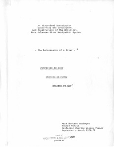
| dc.description.abstract | The purpose of this paper is to give, in as much detail as possible, a complete historical description of the development and construction of the McClellan-Kerr Arkansas River Navigation System. Due to the fact that the project was completed less than a year ago I could find no study written that covered all aspects of the project, thus my research comes totally from primary sources such as published pamphlets, newspapers and magazine articles, and many government documents. Perhaps the most difficult aspect of the paper has been to draw together these varied sources of information into a complete cohesive study. The project we are concerned with is the largest civil works project ever undertaken by the United States government. It cost more than the Panama Canal, the TVA, or the St. Lawrence Seaway. The project began on July 24, 1946, when Congress authorized the development of the Arkansas River and its tributaries for navigation, flood control, hydroelectric power, and recreation. The system consists of seventeen locks and dams that form a stairway 440 miles long with a minimum channel depth of 9 feet and a total lift of 420 feet. It reaches from the Mississippi River to the city of Catoosa in Oklahoma. It consists of a 10 mile long canal from the mouth of the White River to the Arkansas River. From this point the system goes up the Arkansas to Muskogee, Oklahoma, then to the Verdigiris River for the last fifty miles to the port of Catoosa. [3] The study of the project will begin with a description of the Arkansas and its tributaries, followed by a history of man and the river. Next the political fight for
the project will be discussed and also the actual construction. Finally, the results will be analyzed and a look to the future will be presented. [From Preface] | en_US |
| dc.format.extent | 159 pages | en_US |
| dc.language.iso | en_US | en_US |
| dc.rights | This material is made available for use in research, teaching, and private study, pursuant to U.S. Copyright law. The user assumes full responsibility for any use of the materials, including but not limited to, infringement of copyright and publication rights of reproduced materials. Any materials used should be fully credited with the source. | en_US |
| dc.rights.uri | http://rightsstatements.org/vocab/InC/1.0/ | en_US |
| dc.subject.other | Washington and Lee University -- Honors in History | en_US |
| dc.title | The Renaissance of a River: An Historical Description Concerning the Development and Construction of the McClellan-Kerr Arkansas River Navigation System | en_US |
| dc.type | Text | en_US |
| dcterms.isPartOf | WLURG038 - Student Papers | en_US |
| dc.rights.holder | Grobmyer, Mark Wootten | en_US |
| dc.subject.fast | Arkansas River--Navigation | en_US |
| dc.subject.fast | McClellan-Kerr Arkansas River Navigation System | en_US |
| local.department | History | en_US |
